
I first hiked Ngong Hills in 2002. Back then, the dirt road up from Ngong Town had a bit of a reputation. You didn’t just head up there casually on your own and assume everything would be fine. We always went in groups, which was the sensible way to do it. This was far out of town, and not just a casual weekend hiking hotspot.
Ngong Hills then were not the ones people know today. No wind turbines. No disappointing restaurant. No zipline. No built-up activity zone. Once we reached the first place with a proper view to both sides, that was what we called “the Ngong Hills.” That point was before what I would even call the beginning today. A little bit past where Kompass Restaurant sits now was basically the goal. Beyond that was the wilderness. Proper no-go territory unless you had a police escort, and nobody sensible treated that casually.
The Ngong Hills now
That’s why the place feels so different now. These days the hills are much more accessible, much busier, and much more straightforward as a real hiking route. Hikers and picknickers crowd the hills all the way across to Kona Baridi most days of the week, and even more so on weekends. Organised groups do it. Weekend walkers do it. A lot of church groups too. The Ngong Hills are even attracting quite a number of tourists.
On weekend afternoons, the place can get almost annoyingly busy, partially due to young Nairobians who have discovered the qualities of the hills as a party venue. The same goes for all the people who drive up to the lower viewpoints with a few drinks in the evening and enjoy the Ngong Hills sundowner. If you want a more exquisite and far less common experience, try a champagne picnic at sunrise on a clear morning. Not recommended on workdays!
Some credit is also due to Kenya Forest Service here. The presence of rangers, in addition to community engagement as part of the broader push for restoration and conservation means that the riskier deserted spots are gone, so people can feel safe throughout.
As you bump your way up through the trees and past the wind turbines on a road that makes you wince on behalf of your 4×4, it hits you how busy the lower part of Ngong Hills has become. Kompass has been selling ziplining and other activities there for years, and now Wind Planet Adventure Park is advertising a 1.2 km zipline as the longest one on site.
So yeah, if you want that little adrenaline moment before or after your hike, or instead of it, no one is stopping you. Looking at the layout of the hills, I would not be surprised if someone eventually decides to take on the 2.83 km Jebel Jais zipline in Ras Al Khaimah and go for the world record. The lower slopes are crowded enough already. They may as well go all in.
Kompass itself sits in a fantastic location. The view is excellent. So is the setting. Then food competes fiercely with the service about who is more dreadful. With one of the best vistas in the Nairobi region, it takes an effort to ruin the whole experience of a visit to the Ngong Hills, but that’s about the only thing Kompass manages.
As you enter the “wild” part of the hills, you pass a large circular installation that is impossible to miss. If you have flown into Nairobi, you have crossed this point from above before. It is the reference point on the flight path into Jomo Kenyatta International Airport, where inbound aircraft pass overhead.
And then, suddenly, no more wind turbines, no more ziplines, and no more bad restaurants wasting great views.
Just the hills. And roughly four dozen other hikers.
Out on the ridge
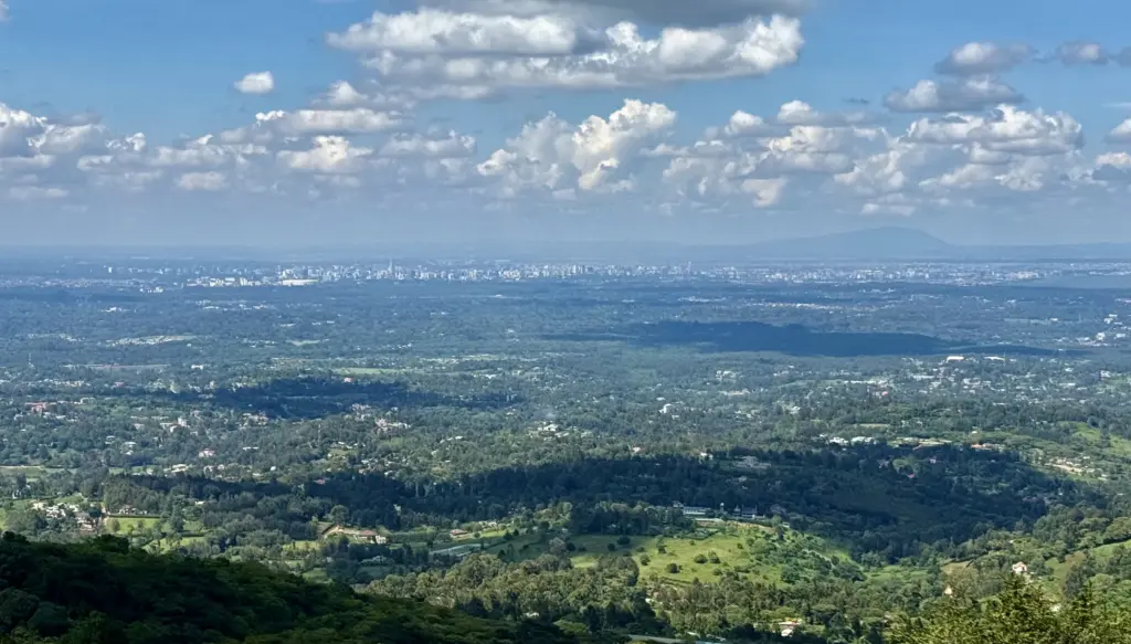
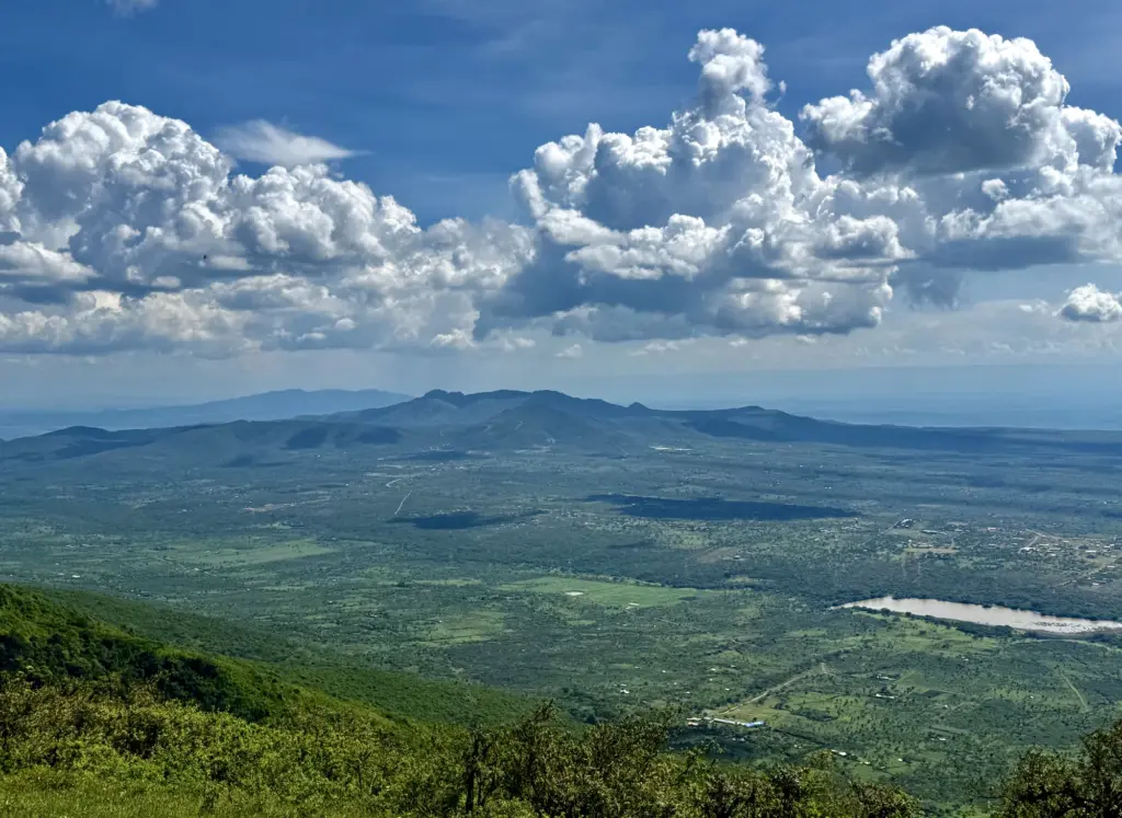
Nairobi spreads out on one side. The Great Rift Valley opens on the other. On the left, Kenya’s busy capital. On the right, the cradle of mankind. It’s one of those views that is hard to describe without drifting into in-flight magazine territory.
Behind Nairobi sits Ol Donyo Sabuk, one of the nicer, more excursion-like hikes near the city. Out in the Rift Valley you have Mount Olorruka, Mount Olorgesailie and its prehistoric stone tool factory site, and Mount Suswa. In the distance there’s also Mount Longonot, and if the air is absurdly clear, you may even see Mount Kenya. I wouldn’t plan around that.
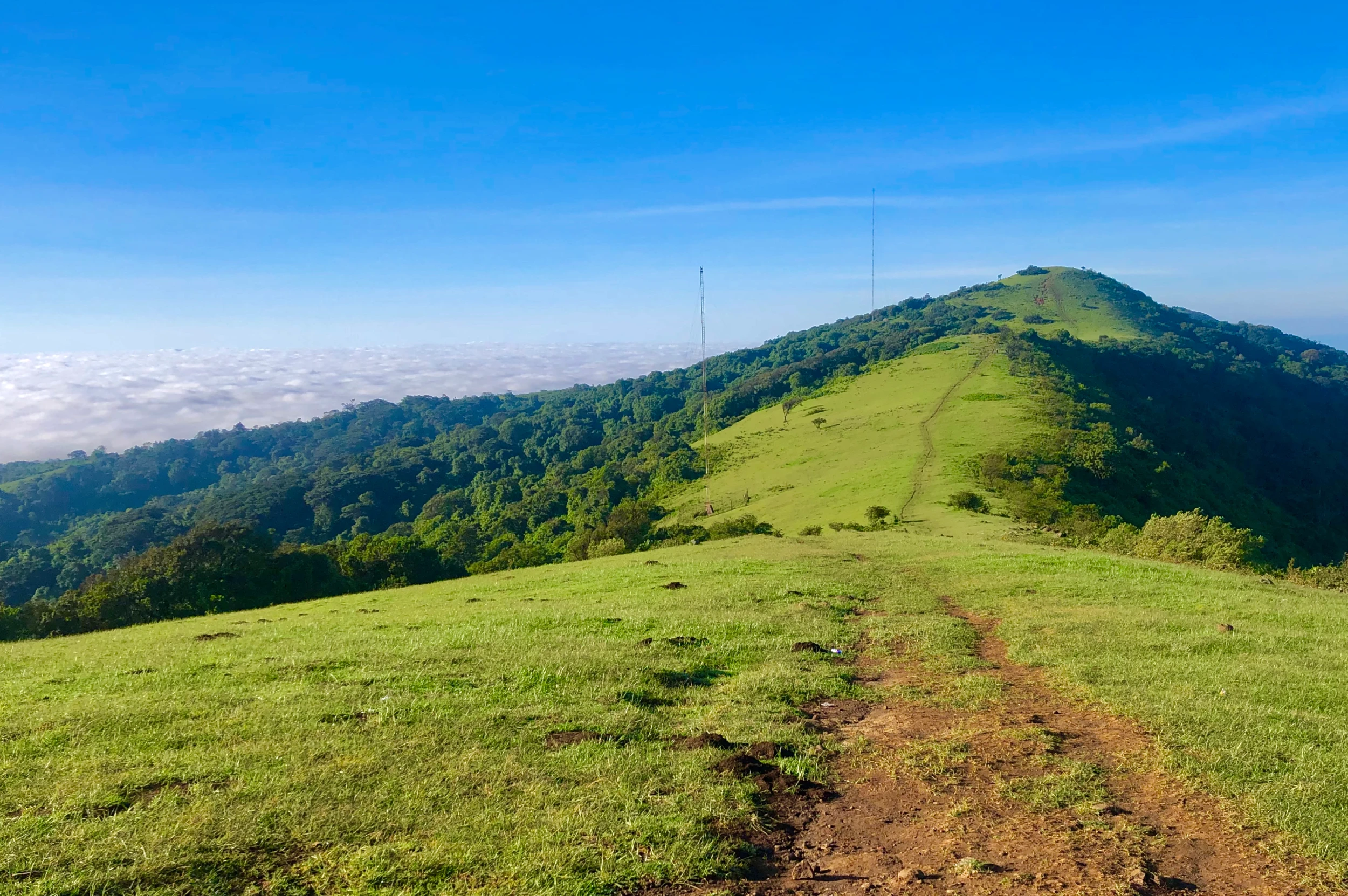
First comes a hill that barely qualifies as a hill. It can easily fool you into thinking the rest will be a stroll. Then you start on Nurregoi.
That one you feel in your legs.
The good news is that once you reach Nurregoi Peak, the second-hardest hill is behind you.
The next one, the Chemesyew peak feels easy in comparison. Probably because it is. By then you feel it in your whole body anyway, because this is where it starts to get seriously windy. With a sweaty T-shirt and some fierce sun, that chilly wind that dries you up while cooling you down feels just right at that point. At least for me. Then again, I’m Norwegian.
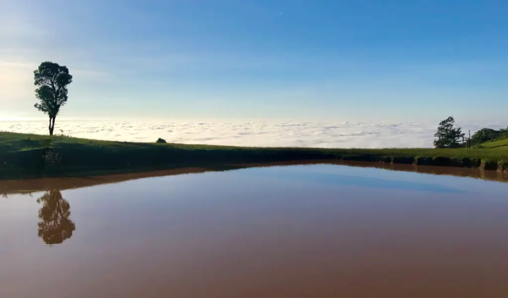
The descent from Chemesyew is one of the best-looking stretches in the Ngong Hills. You get clear views toward the 6th hill and Borowon’niin, with the Rift Valley sitting behind the whole scene. It is the kind of section where you keep stopping every few metres because the angle somehow gets better again.
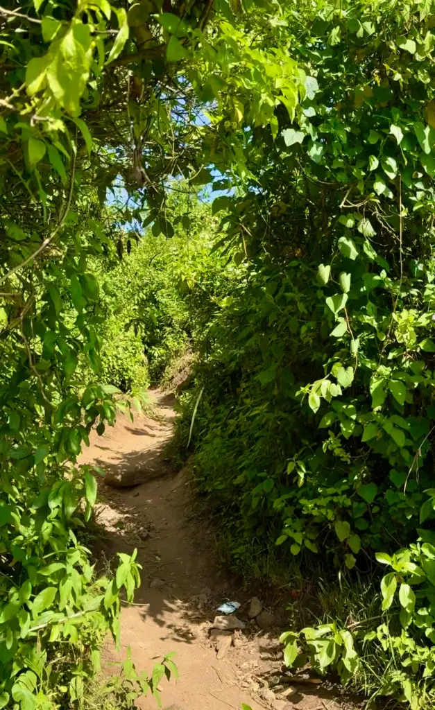
Whether you wanted a change of scenery or not, this is where it comes. As you start on the 6th hill, the trail cuts into a narrow corridor through bush forest. There is no chance of getting lost. You just follow the only way through.
If Nurregoi felt tough, the 6th hill is slightly worse. At least the bushes give some shade. Most of it is a long, winding green corridor across steep ground, broken only by the occasional opening where the Rift Valley shows itself through the vegetation.
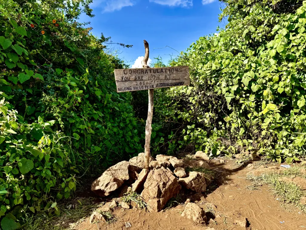
The Peak
From the 6th hill, it is a short walk to the Ngong Hills peak, and by then the worst is mostly behind you. The peak is boxed in by dense bushes to the north, east, and west, so the only real view is toward Kona Baridi and Champagne Ridge. On a very clear day, you can also see Mount Kilimanjaro. If I ever get that lucky, I will definitely post about it.
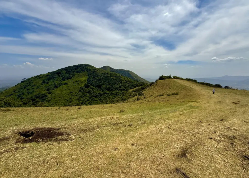
From there, the route drops more gently along the southern slopes toward Kona Baridi.
This is where the landscape opens up again. The trail runs into wide open ground with views over Champagne Ridge and the Rift Valley. Mount Olorruka, which has been sitting somewhere on the horizon for most of the walk, becomes much more prominent on the final descent. By then, the hard work is done and what remains is a very pleasant stroll.
Kenya being Kenya, a proper hike deserves a reward. That usually means mbuzi choma (roasted goat).
The valley west of the Ngong Hills is Maasai land, where goats roam freely their whole lives, feeding on shrubs and bushes. That gives the meat a distinct flavour and tenderness, and nowhere is that clearer than in the choma joints around here. This is some of the best nyama choma (roasted meat) you will get in Kenya, and frankly just about anywhere.
I rarely miss that opportunity after hiking the Ngong Hills. The area is dotted with places where the smell of roasting goat reaches you long before you arrive, so once the hike is done, go for it. You’ve earned it.